
This summer I’m working with Earth Genome to investigate a series of critical environmental concerns searches in Earth Index, and publish those findings. After just a few days, there are already new discoveries to share.
Palm oil is one of the leading drivers of tropical deforestation. While much of the industry made commitments to end deforestation over a decade ago, there’s been a recent increase in forest loss due to loopholes in fragmented supply chains. Mapping palm oil processing facilities is a critical part of improving traceability and the Universal Mill List (UML) is one of the most trusted public datasets on palm oil mills. In Peninsular Malaysia, one of the world's largest palm oil-producing regions, Earth Index found 17 additional possible mills outside of the 268 verified mills in the Universal Mill List. In Indonesian Papua, where forest loss surged in 2025, Earth Index identified 5 potential new mills in a region with just 12 verified facilities.
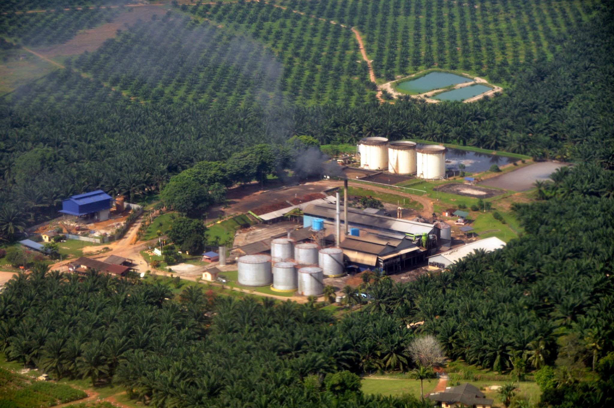
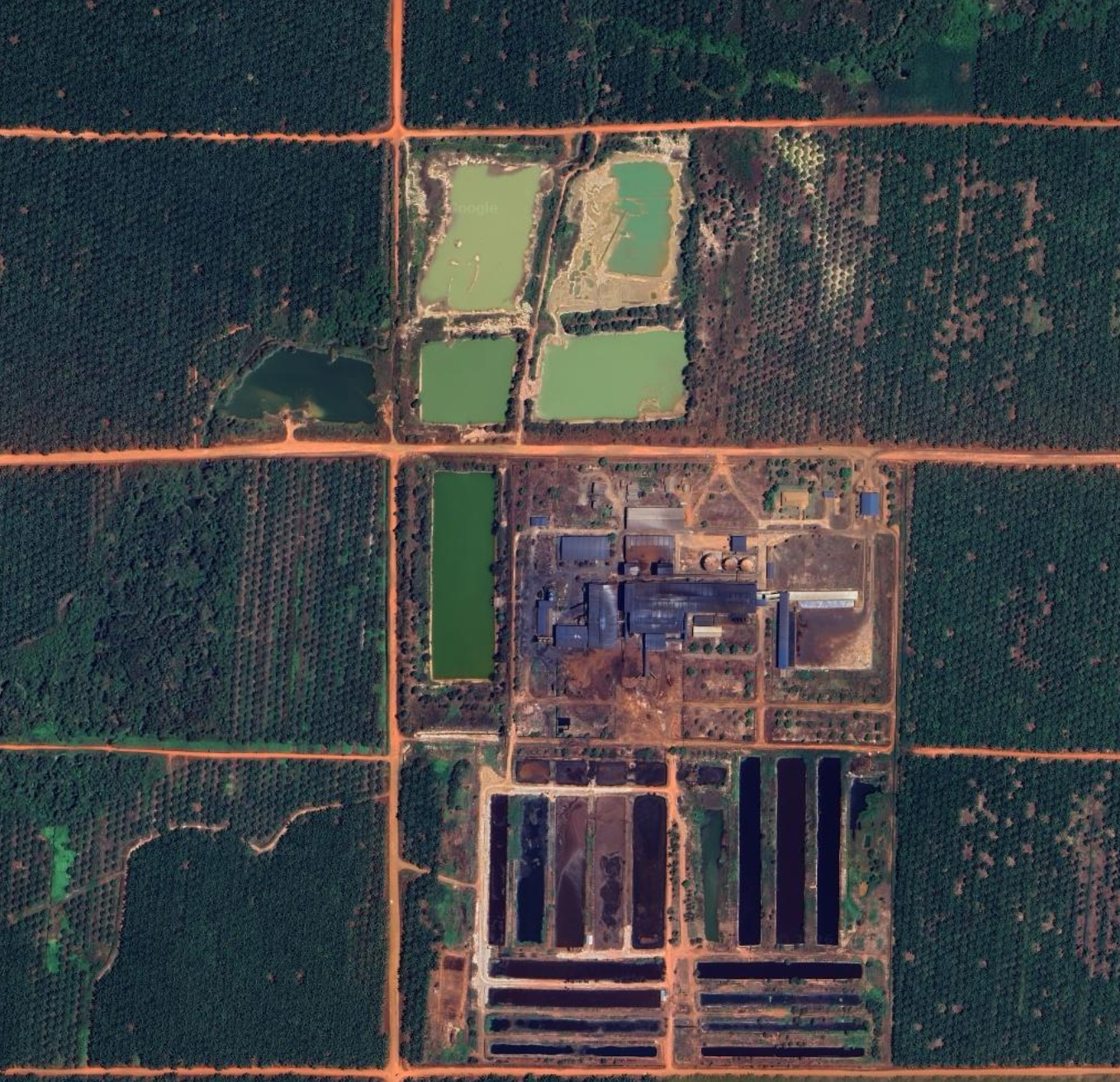
Mills are also an environmental concern in their own right. Palm oil processing produces large volumes of Palm Oil Mill Effluent (POME), a wastewater with high concentrations of organic matter, oil, and grease. POME is often stored in open-air lagoons and can be devastating if it enters local waterways through illegal dumping or storm runoff. These lagoons are both important features to monitor and distinct visual markers of palm oil mill facilities.
Browse the results for Peninsular Malaysia and Indonesian Papua.
The process for searching for mills in Malaysia and Indonesia using Earth Index
I started by importing and converting verified mill locations from the Universal Mill List into positive labels, ensuring the labels covered key mill infrastructure, like effluent lagoons. I ran an initial pass with Quick Search and sorted the predictions into positives and negatives, toggling between detailed Mapbox Satellite imagery and current Sentinel-2 imagery. I verified potential mills on Google Maps, looking for labels in Malay such as “kilang kelapa sawit” or “palm oil mill”. False positives included rubber facilities, lumber mills, mosques, livestock farms, and aquaculture ponds, which I labeled as negatives. I also added negative labels to areas that clearly didn’t have mills, such as undisturbed forest and cities like Singapore.
Once I had a few hundred positive and negative labels, I moved on to Deep Search, which surfaced hundreds of new predictions and even more potential mills. I repeatedly ran Deep Search, reviewing and labeling predictions, until I stopped finding new mills. Deep Search demonstrated greater generalizability, identifying mills with less common infrastructure, such as enclosed silos for effluent storage. I further confirmed by consulting other data sources and web searches.
How did we do? What did you find?
After numerous iterative searches, Earth Index found mills likely missing from the most authoritative palm oil supply chain dataset, even in one of the world's most closely monitored palm oil regions. I’d love feedback from those with local knowledge to confirm these are valid palm oil mill locations, and if these are truly new sites to the UML. Some locations are hard to categorize and have a somewhat atypical appearance, so we're really looking for input from others. We'll then look into submissions to update the UML.
More to come soon on critical use cases. Run searches yourself on https://earthindex.ai/ and let us know what you find, and if you need a hand, we can help take a closer look.
Other articles

.png)
The AI Knowledge Problem
Report out on building decision support tools for nature credit project design
.png)

Engineering updates on sustainable AI at Earth Genome
Behind the scenes sustainability improvements on patch grid generation, STAC metadata, energy transparency, and DB optimization.
