
Today we are proud to announce that Earth Index is open to anyone, anywhere in the world. To sign up, just head to app.earthindex.ai to register for an open account.
Making progress on the world’s many environmental challenges requires better tools. That’s why we built Earth Index, a tool that enables easy mapping of environmental targets by leveraging AI foundation models for satellite imagery.

In the short time that Earth Index has been available, we’ve been amazed by the impact our users have made. Just to highlight a few: they’ve exposed narcotrafficking airstrips in the Peruvian Amazon; mapped illegal palm oil expansion in Brazil; uncovered hazardous quarries in the Balkans; and even mapped how rose farming is contributing to wetland loss in Uganda.
Despite the potential of Earth Index, it has been limited in one key respect: to date, it has only been available for a limited set of users. Today that changes.
What’s launching today
Starting today, Earth Index is now open for anyone to sign up and start exploring immediately – no waitlist, no approval process. Our new free "Open" tier gives real, usable access to Earth Index to anyone who is interested in better mapping and understanding their local environment.
Open access users will enjoy full geographic access (anywhere, planet-wide) and a full feature set including uploads (for reference data) and downloads (for mapped points).
For users who would like more advanced features, we’re launching a “Full” tier of Earth Index access. Full access users will have access to higher usage quotas and additional features like “Deep Search” (a more powerful way to map) and API access to Earth Index.
Users can easily request Full tier access through the application. Earth Genome will then review requests and promote approved users to the Full tier. Just like the Open tier, we plan to make the Full tier available at no cost for select grassroots and high impact environmental users. Our hope by offering both “Open” and “Full” tiers of access is to widen the aperture of what is possible with Earth Index (through Open) while ensuring that resource-consuming workloads are reserved for highest priority use cases (through Full).
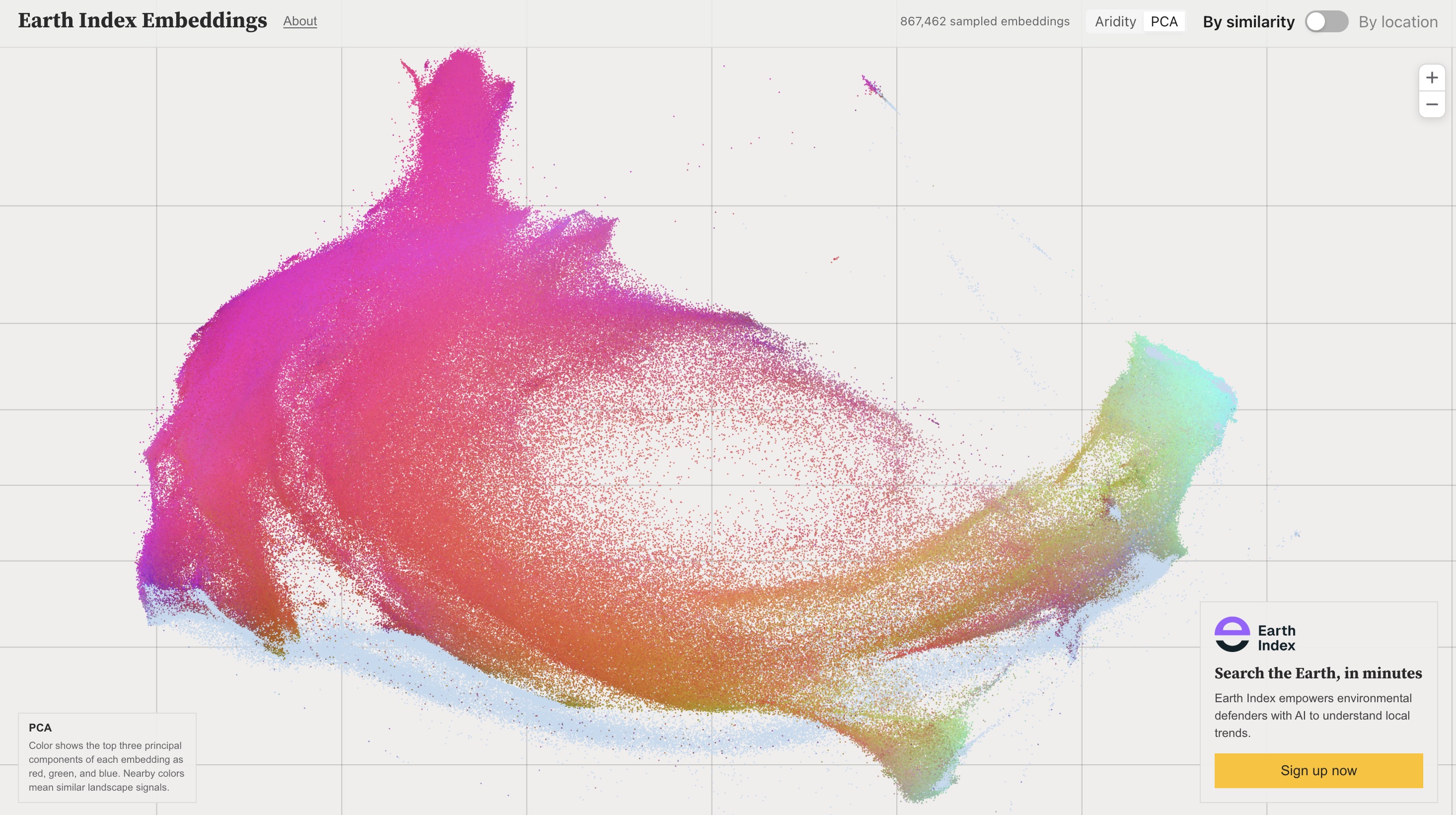
To cap off the exciting news: today, we’re also launching a completely new set of embeddings that power Earth Index – for both 2024 and 2025. According to our internal evals, these are the most capable Earth Index embeddings ever. I can’t wait to see what users do.
Sign up today
There has never been a more important time to start mapping the planet. The need has never felt more acute – and the technology has never been more capable.
If you’re curious to see how the world around you is changing – sign up for Earth Index today.
Other articles

.png)
The AI Knowledge Problem
Report out on building decision support tools for nature credit project design
.png)

Engineering updates on sustainable AI at Earth Genome
Behind the scenes sustainability improvements on patch grid generation, STAC metadata, energy transparency, and DB optimization.
