
Until now, Earth Index could show how landscapes changed from one year to the next. With Monthly Search, now in beta, you can automatically track changes in local landscapes month to month. Scroll down for how to request access.
Our partners face threats and challenges ranging from combating illegal gold mining in the Amazon to documenting the explosive growth of data centers in the US. These changes unfold very rapidly, making timely information essential to planning and effective action. Earth Index allows non-technical users to leverage satellite imagery in sophisticated ways, training locally fine-tuned models to track phenomena of interest. With monthly updates, partners can spot change in weeks rather than waiting a year to act on it.
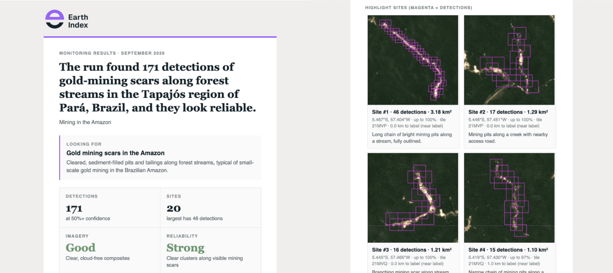
Users set up a “Monthly Search” project in Earth Index and are guided through an iterative labeling and model training process. Once that process is complete, users deploy the model across any recent month and set it to run automatically in future months. After monthly runs are complete, users can compare results and see where trends are emerging. Each month, users get an AI-powered summary email that explains what changed and flags where image quality or seasonality might affect the results.
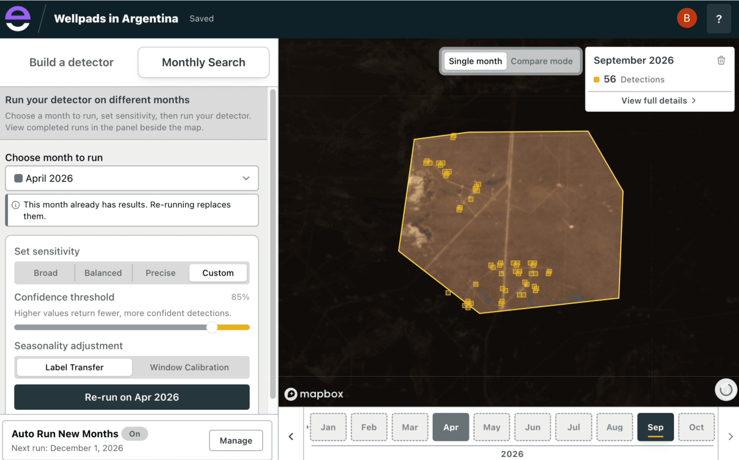
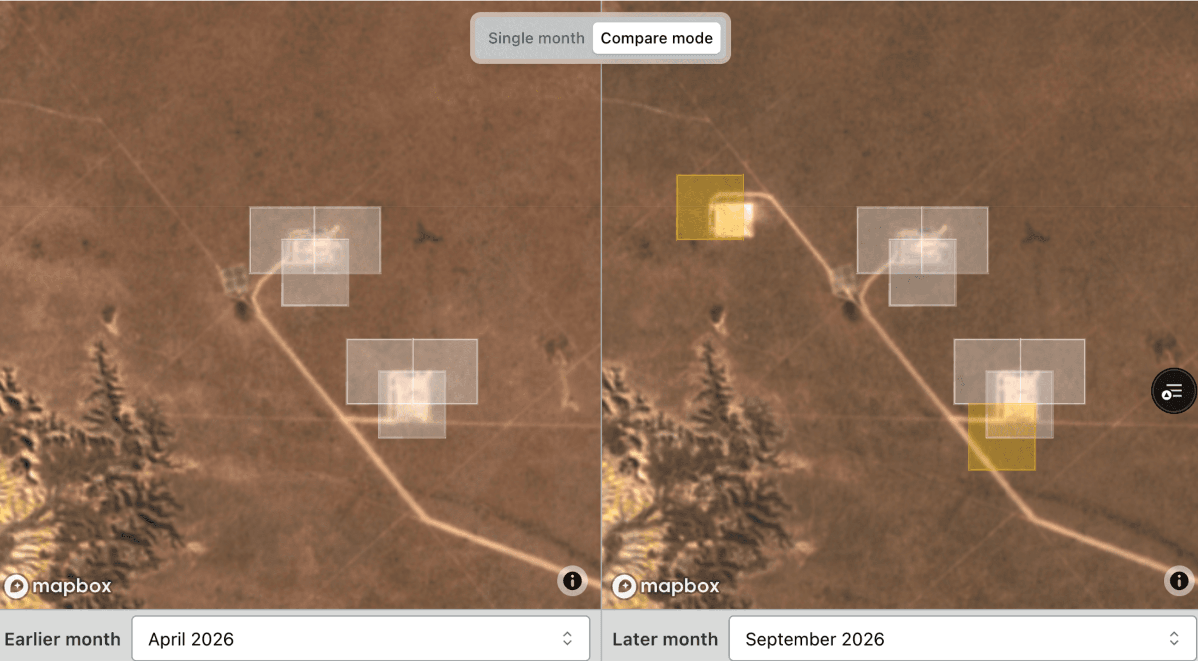
I’m proud of what we’ve built to support this new capability. Updated pipelines now efficiently generate and analyze imagery and embeddings month by month. We’ve also redesigned the UI to guide users through what can be a complex process of setting up a project and interpreting monthly model results. Seasonal shifts in vegetation and lighting can look like real change; we’ve developed methods to separate the two. Technical blog posts with more details are coming soon.
I can’t wait to see what our users will do with Monthly Search. The planet is changing quickly, and we need to act just as quickly to defend it.
Interested in trying Monthly Search? Register at earthindex.ai, request Full Access, and tell us about your work and how Monthly Search could support your environmental goals.
Other articles

How we cut our vector search bill by nearly $10,000 a month with Lance
We replaced our vector database with Lance files on S3 and one server that keeps only the indexes locally on disk. This is how we built it.


Earth Index embeddings and imagery: source.coop data update
We’re releasing major updates to both our embeddings and imagery, again both are available on Source.coop.


Search for Stuff: build a map layer by describing what you want to find
You can now create reference layers in Earth Index by describing what you want to find in plain language.